Ventura County
THE VARIED 43-MILE* VENTURA COUNTY COASTLINE offers everything from quiet sandy beaches and exceptional Point Mugu State Park to some of the worst excesses of beach armoring on the entire coast of California. Mountains crowd the coastline both north and south where Highway 101 runs between the base of the mountains and the ocean replete with miles of seawalls constructed to protect the roadbed from erosion. (* Ventura County's Coastal Trail is 52 miles because of detours.)
Between the bookend mountains, the Oxnard Plain and the Santa Clara Valley support a thriving agricultural industry and bustling, growing towns. The City of Ventura boasts one of the best historic downtown districts anywhere on the California coast with a Spanish mission, museum, a significant archeological site marking the earliest mission, and an old Main Street retaining the flavor of what a town was like before shopping malls.
The county hosts the Channel Islands National Park Visitor Center, a fine place to find out more about the five islands lying between 10 and 45 miles offshore, and the Visitor Center and Headquarters for Santa Monica Mountains National Recreation Area, located inland at Thousand Oaks. Oil production is prevalent in the county with older onshore facilities on the north coast and newer offshore platforms on the ocean horizon. The Naval Air Weapons Station protects a significant marine estuary and wetland, Mugu Lagoon. Amidst the shoreline development, truly fine beaches offer places to stroll, swim, surf, fish or rest in the mild semi desert climate. Inland, the rugged mountains of Los Padres National Forest offer camping, hiking and backpacking and contain the Sespe Condor Sanctuary and the Sespe, Matilija and Chumash Wilderness Areas.
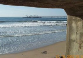
Ventura County's CCT starts at the famous surfing spot Rincon Point and then negotiates Highway 101 for several miles before reaching the relatively uncrowded Old Pacific Coast Highway. At Emma Wood State Beach, the CCT abandons the road and hits the beach along an untamed stretch of shoreline before reaching the Ventura city waterfront. Beyond the Ventura City Pier, our route takes to the long sandy beach fronting the plains. This middle part of Ventura County's Coastal Trail on pleasant beaches suffers interruption by man-made barriers. Three detours result from two small boat harbors carved out of coastal dunes and marshes, deep water Port Hueneme and two Navy bases.
At the south end of the county, our CCT route negotiates a combination of the road shoulder and beaches at the base of the scenic and dramatic Santa Monica Mountains through Point Mugu State Park. Starting at Mugu Rock, the historic Chumash Trail climbs into the mountain backcountry. Down the coast a little farther the Santa Monica Mountains Backbone Trail begins at the Ray Miller Trailhead in La Jolla Canyon. Ventura County's Coastal Trail ends at Leo Carrillo State Beach just across the Los Angeles County line.
Explore the Trail
Click a section to discover more detailed information on pieces of the trail that can be explored within a day. Find highlights of what each area has to offer as well as other resources.

Ventura Section 5


