
Usage Notes

Legend: For details on the icons and trail colors, please click the legend icon on the map above.

Layers: Other layers are available. See the California Coastal Commission and Coastal Conservancy Completed Sections layer for the official completed trail segments. (About progress on the trail completion project.)
Monterey Section 5
Asilomar State Beach to Point Joe to Carmel City Beach
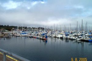
You've probably heard of the famed 17-Mile Drive that explores the exclusive Pebble Beach/Del Monte Forest corner of the Monterey Peninsula. Billed as "Nature's Drive-Through," you can motor the scenic toll road for a fee. The California Coastal Trail offers a healthier, no-fee and vehicle-free tour of the same environs, reaching one of the trail's affluent highlights. This CCT section traverses the Del Monte Forest lands of the venerable Pebble Beach Company, passing the seven world famous golf courses on Monterey Peninsula's wooded windward side. CCT passes right by the famed Pebble Beach Golf Course and ends at the north end of sparkling Carmel City Beach. Very few people know about this combination of trails that explore shore and forest in this swank resort area, and even fewer people use these paths. Enjoy this unique and lightly traveled leg of the CCT and marvel that a public trail explores these gorgeous, posh environs. Another choice is bicycling the 17-Mile Drive, also toll free.
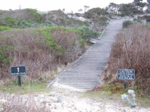
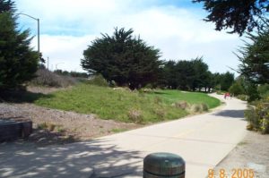
The section starts on the beach side of Sunset Drive across the street from the pergola (gateway) marking the west end of the pedestrian boardwalk into the Asilomar Conference Grounds. Follow the path that leads down to the tideline of Asilomar State Beach. Turn left and follow the tideline southwest along the shore of Spanish Bay. (Another choice is to follow the boardwalk of the Spanish Bay Shoreline Pedestrian Trail from Asilomar State Beach until it ends, then continue along the tideline.) You quickly leave the Asilomar grounds and follow the tideline of what has traditionally been called North Moss Beach.
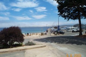
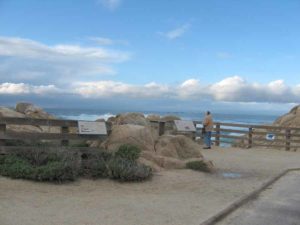
By ⅜ mile you pass a small point marking your passage to South Moss Beach. Continue along an increasingly wild beach that contrasts with the groomed greenery of the Spanish Bay Golf Course not far inland. Pass the Spanish Bay Beach parking lot around ½ mile and continue down the strand. Cross Sawmill Gulch beyond ¾ mile, approaching the end of the beach. The sandy beach ends by one mile where CCT swings northwest, paralleling rough cobble beach to a point. After rounding a north-facing promontory, the path heads for west-facing Point Joe. Reach Point Joe around 1⅜ miles. This most exposed point on the entire Monterey Peninsula was named for the Chinese man who lived here in a driftwood shelter in the early 1900s. From the point CCT follows the west shoulder of paved 17-Mile Drive briefly, but it soon picks up a separate path along the bluffs that occasionally returns to the road shoulder. Continue past small promontories around 1¾ miles and 2⅛ miles, then past a small cove around 2⅜ miles where the Shore Course of the Monterey Peninsula Country Club lies across the street. As you continue south, CCT soon parallels the paved access road to a large parking lot at the point overlooking Bird Rock at 2¾ miles. You might make use of the only restroom and drinking fountain directly on this CCT section before its end. In addition to providing nesting sites for gulls and seabirds, barren Bird Rock provides a haul-out for sea lions and harbor seals.
From the Bird Rock Overlook, CCT follows the Nature Trail south from the point. It soon leads to the little-known, little-used fine white sand beach at the mouth of Seal Rock Creek. Where the path forks, you can descend to the beach for the shortest route or continue on the Nature Trail, slightly longer. Seal Rock rises beyond the breakers to the southwest.
Just beyond the beach the Nature Trail ends at a signed equestrian trail. Follow the horse path, marked by green and white posts with a green square, along the bluff's edge. Around 3¼ miles the equestrian trail meets 17-Mile Drive. If you must have a coastal view on the next stretch or want to visit Fanshell Beach, Cypress Point or the Crocker Grove of Monterey cypress to the southwest, you need to follow the road shoulder from here. The Coastal Trail crosses 17-Mile Drive and follows the horse trail inland, climbing southeast on the loose-sand track into the dunes. As you labor up this tough hill (tough because of the loose sand), be sure to turn around and enjoy the grand vistas of the coast you just walked and wooded Cypress Point southwest.
At the top of the dune, the green blazes inexplicably give way to red ones.
Follow the red trail as it veers left and soon descends with golf course views, coming to a path marked Del Monte Forest Trail. Make a sharp left turn here and ascend. You're still on the red-marked route, but you see no marker for about 200 feet. You soon come to a road with red markers on both sides. You can see the Spyglass Hill Clubhouse not far north. Walk east across the road, then veer right to follow the blue-marked path south along a ridgetop.
At 4 miles CCT crosses a road called Bristol Curve. Continue on the blue path, marked with orange at intersections, parallel to Stevenson Drive. By 4⅛ miles your path meets Stevenson and an important intersection. The blue path crosses the road to head for the nearby stables. You want to turn left and follow the orange-marked path northeast into forest, then follow it east with the driving range on your right.
Around 4¼ miles your orange trail crosses Forest Lake Road and climbs northeast. You can take a ¾-mile side trip down Forest Lake and Alvarado, turning right to descend 17-Mile Drive to the famous Lodge at Pebble Beach where you might lunch at one of four restaurants or visit the coastal access to Stillwater Cove, down Cypress Drive from the lodge.
CCT ascends northeast on the orange/blue trail, lined with fences here, through forest, crossing quiet roads in an exclusive residential neighborhood. Continue ascending the path until it crests a hill and descends briefly to cross a quiet street. Follow it across a 2-lane street and down through a gully, then rise to another 2-lane road, cross it and continue your ascent.
When you reach a trail junction with a golf tee on your left, turn right to head southeast with the Poppy Hills Course on your left. Contour beside the course to 5⅛ miles, where you meet Ronda Road near a stop sign. Cross Ronda and follow the orange-blazed trail across Spruance Road around 5⅜ miles. Then your path veers right, following orange blazes paralleling Spruance on a gentle descent. After veering away from Spruance your orange path descends to a curving road at 5¾ miles. Stay on its left past a green-marked trail junction, then climb along a fire road that soon turns southeast, then south through the de facto wilderness of Del Monte Forest.
Where the fire road swings left to head east, CCT continues south, descending a narrow path. At a vague junction, head south on the path marked by an Orange arrow. Descend to a 2-lane road, cross it and continue downhill on the orange blaze path. While the tread is indistinct, the route is well blazed. Tread improves after another paved road. Descend to a trail junction around 6⅛ miles where you veer right to follow the orange path. Contour above deep, wooded Pescadero Canyon on your left, which divides Del Monte Forest from Carmel. You soon descend south through the forest with filtered views of the coast ahead. Around 6⅝ miles you drop to a busy 2-lane road, famous 17-Mile Drive. Turn left and follow it 125 feet. Just before a road sign at a Y, descend southwest on an unmarked trail. It comes to 2-lane Carmel Way. You can turn right and descend the road shoulder 400 feet to its crossing of Pecadero Creek. The CCT crosses the road and descends on vague tread. Turn right and follow an old path, in places stone wall-lined, downstream. It passes a private path with a bridge over Pescadero Creek, then continues downstream through a pleasant redwood grove.
About 700 feet before Carmel Way, the path disappears. Pick your way through tall grass to a stone pillar beside Carmel Way around 7⅛ miles. Set in the stone wall facing the road, a brass plaque reads "HORSE TRAIL--REDONDO REAL." Cautiously cross Carmel Way to a gravel road with a stone garage on its right.
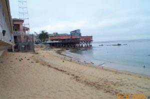
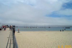
Follow that road 350 feet to its end at the famous Pebble Beach Golf Course. Then follow a vague path marked by low stakes along the left edge of the course above Pescadero Creek, heading southwest toward the creek's mouth. Please be quiet if golfers are present. Near the mouth of the creek, descend a narrow path to the beach at 7½ miles. Turn left and follow the tideline to section's end at the Carmel City Beach parking lot at the end of Ocean Avenue at 7⅝ miles.
If the trail is flooded near the creek's mouth in winter, continue along the street ¼ mile, passing Carmel Gate where Carmel Way becomes North San Antonio Avenue. Follow it to the stop sign at 4th Avenue. Turn right and walk what looks like a driveway with a metal fence on your right. In 125 feet you'll find a post marked "ACCESS." Follow this path 250 feet to forks at the top of the a beach. The right fork drops to the tideline. Take the left fork south past volleyball posts and a restroom to section's end at the parking lot at Ocean Avenue's end.
ALTERNATE ROUTE: From the dune path junction at 3¼ miles, you can continue along the shoulder of 17-Mile Drive around Cypress and Pescadero points until you reach the brass plaque on Carmel Way at 8¼ miles (ideal for bicyclists).
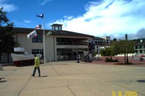
SUGGESTED ROUND TRIPS & LOOPS: Walk the shoreline to Point Joe or Bird Rock, returning via the Spanish Bay Shoreline Trail. Walk the whole section to Carmel City Beach and catch the #22 bus, asking the driver for a transfer and directions to Asilomar. Explore the scenic Asilomar Conference Center and its architecture.
Distance: 7⅝ miles (12.3 kilometers).
Open to: Hikers. Equestrians from Seal Rock Creek Beach south to section's end. Bicyclists can follow 17-Mile Drive's shoulder without paying a fee.
Surface: Trail, boardwalk, beach, road shoulder.
Access point: Asilomar State Beach.
How to get there: Hikers. Equestrians from Seal Rock Creek Beac
Other access: Various points along 17-mile Drive (toll charge for vehicles).
Difficulty: Easy
Elevation gain/loss: 665 feet+/665 feet-. To Seal Rock Picnic Area: 55 feet+/55 feet-.
Cautions: Please stay off adjacent private property and respect privacy of residents. Equestrians have the right of way on horse paths-give them plenty of room to pass. Please respect the quiet required by golfers when you walk past them playing their round.
Further information: Asilomar State Beach (83 1)372-4076, 17-Mile Drive (831)624-3811, Carmel City Beach (831)624-3543.
Facilities: Restrooms, water, phone at Asilomar Conference Grounds Reception Area near start, at Bird Rock Overlook and at Carmel City Beach at end.
Campgrounds: Veteran's Memorial County Park is in Monterey near the Presidio, about 2 miles southeast. Laguna Seca Recreation Area 11 miles east has 183 sites.
Lodging: Asilomar Conference Center at section's start has 315 rooms. Upscale lodgings along route include The Inn at Spanish Bay and The Lodge at Pebble Beach. The Monterey Peninsula has many other choices.
Points of Interest


In the News


Interested in contributing to this project?
Register to add new photos and information, update existing results and share your trip reports.