Santa Barbara County
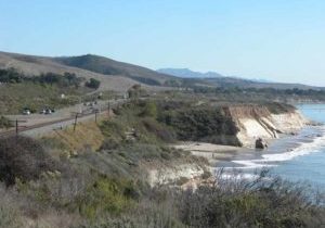
A DISTINCT CAPITAL LETTER L describes the Santa Barbara County coast on the Golden State's shore. Santa Barbara County's wild north coast forms the L's vertical. The L hinges on rugged, inaccessible Point Conception, and the sheltered and sun-warmed south coast makes its horizontal arm. Mountains rim this entire coastline, with a narrow coastal marine terrace wedged between the precipitous mountains and the shore. Only in the southeastern county does the terrace fan out to a width of two or three miles. The steeply sloped mountains provide a spectacular backdrop to the shoreline's diversity, the Coast Range rising 2000 feet along the north coast and the Santa Ynez Range towering up to 4000 feet above the south coast.
In Santa Barbara County the Coastal Trail explores a land of contrasts. Here the CCT traverses the most populous county since San Francisco, yet hikers will marvel at how few people they'll see along 90 percent of its shore. The wind- and wave-swept north coast is remote and rugged, much of it inaccessible, while the south coast sprawls along the sunny base of the mountains, with Highway 101 running most of its length. Vast stretches of the Santa Barbara coast are preserved in parks welcoming visitors, but hikers may be arrested for visiting other coastal places. Much of Vandenberg Air Force Base's long coast is off limits to visitors, and three immense private ranches, remnants of old Spanish ranchos, and a coast guard reservation warn trespassers of arrest.
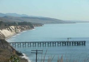
Along Santa Barbara's wild north coast, the CCT first explores the Guadalupe Dunes, climbing the flank of the west coast's highest dune to reach remote Paradise Beach. As the Coastal Trail makes a dramatic ascent of Point Sal Ridge, it overlooks the immense Vandenberg base which occupies the next 35 miles of Santa Barbara's shoreline. The CCT currently follows roads to get around this bastion of national security, but we describe Alternate Routes exploring ten miles of Vandenberg's shore. Another Alternate Route heads south from Jalama Beach County Park, getting as close to Point Conception as one can without a boat or train ride. After more than 50 miles of road detours through coastal valleys and hills, the CCT reaches the south coast at Gaviota Pier. For nearly all of its final 50 miles through Santa Barbara County, the Coastal Trail follows beaches and bluffs along the sunny south-facing shore, where water temperatures are ten degrees warmer than north of Point Conception, with gentler surf, cruising porpoises and Channel Islands views as a bonus. From Gaviota the CCT's next 22 miles mostly follow lightly used beaches passable only at medium to low tides and notably free from development.
Once the CCT reaches the university town of Isla Vista on the western outskirts of Santa Barbara, the shoreline's popularity rises dramatically. Still, as the CCT continues along the Santa Barbara waterfront on gorgeous beaches at the base of steep towering bluffs, what most impresses one about the fine beaches is their seclusion. When the quiet beaches finally give way to an urban waterfront, the CCT passes through the city on sparkling beaches along one of the most pleasant and well loved urban shorelines in California.
East of the city, the CCT continues along beaches and bluffs through exclusive urban neighborhoods, friendly small towns, and beside rich agricultural lands. After passing through Carpinteria, famed for the safest beach in California, Santa Barbara's Coastal Trail ends after 112⅝ miles.
Explore the Trail
Click a section to discover more detailed information on pieces of the trail that can be explored within a day. Find highlights of what each area has to offer as well as other resources.
Usage Notes

Legend: For details on the icons and trail colors, please click the legend icon on the map above.

Layers: Other layers are available. See the California Coastal Commission and Coastal Conservancy Completed Sections layer for the official completed trail segments. (About progress on the trail completion project.)


